


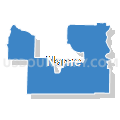
Henderson, Hardeman, McNairy, Hardin, Haywood & Decatur Counties PUMA, Tennessee
About
Outline

Summary
| Unique Area Identifier | 194002 |
| Name | Henderson, Hardeman, McNairy, Hardin, Haywood & Decatur Counties PUMA |
| State | Tennessee |
| Area (square miles) | 3,235.11 |
| Land Area (square miles) | 3,194.98 |
| Water Area (square miles) | 40.14 |
| % of Land Area | 98.76 |
| % of Water Area | 1.24 |
| Latitude of the Internal Point | 35.20991450 |
| Longtitude of the Internal Point | -88.35480080 |
Maps


Graphs
Select a template below for downloading or customizing gragh for Henderson, Hardeman, McNairy, Hardin, Haywood & Decatur Counties PUMA, Tennessee


Neighbors
Neighoring Public Use Microdata Area (by Name) Neighboring Public Use Microdata Area on the Map
- Land Between the Lakes--Weakley, Henry, Carroll, Humphreys, Benton & Houston Counties PUMA, TN
- Lauderdale, Colbert, Franklin & Marion (Northeast) Counties PUMA, AL
- Lawrence, Giles, Wayne, Lewis & Perry Counties PUMA, TN
- Madison & Chester Counties--Jackson City PUMA, TN
- Northeast Region--Marshall, Alcorn, Prentiss, Tippah, Tishomingo & Benton Counties PUMA, MS
- Northwest Tennessee--Gibson, Dyer, Obion, Crockett & Lake Counties PUMA, TN
- Tipton, Fayette & Lauderdale Counties PUMA, TN
Top 10 Neighboring County (by Population) Neighboring County on the Map
- Madison County, TN (98,294)
- Lauderdale County, AL (92,709)
- Tipton County, TN (61,081)
- Fayette County, TN (38,413)
- Alcorn County, MS (37,057)
- Carroll County, TN (28,522)
- Lauderdale County, TN (27,815)
- Henderson County, TN (27,769)
- Hardeman County, TN (27,253)
- McNairy County, TN (26,075)
Top 10 Neighboring County Subdivision (by Population) Neighboring County Subdivision on the Map
- District 6, Madison County, TN (10,757)
- District 10, Madison County, TN (9,943)
- District 8, Madison County, TN (8,291)
- District 1, Alcorn County, MS (7,546)
- District 5, Alcorn County, MS (7,271)
- District 7, Madison County, TN (7,159)
- District 7, Tipton County, TN (6,447)
- District 2, Tipton County, TN (6,353)
- District 3, Hardeman County, TN (5,750)
- District 1, Tipton County, TN (5,625)
Top 10 Neighboring Place (by Population) Neighboring Place on the Map
- Corinth city, MS (14,573)
- Brownsville city, TN (10,292)
- Lexington city, TN (7,652)
- Savannah city, TN (6,982)
- Bolivar city, TN (5,417)
- Whiteville town, TN (4,638)
- Selmer town, TN (4,396)
- Clifton city, TN (2,694)
- Bells city, TN (2,437)
- Parsons city, TN (2,373)
Top 10 Neighboring Elementary School District (by Population) Neighboring Elementary School District on the Map
- Lexington City Elementary School District, TN (7,652)
- Alamo Town School District, TN (4,226)
- Bells City School District, TN (3,710)
Top 10 Neighboring Secondary School District (by Population) Neighboring Secondary School District on the Map
- Henderson County School District in Lexington, TN (7,652)
- Crockett County School District in Alamo, TN (4,226)
- Crockett County School District in Bells, TN (3,710)
Top 10 Neighboring Unified School District (by Population) Neighboring Unified School District on the Map
- Jackson-Madison Consolidated School District, TN (98,294)
- Tipton County School District, TN (61,081)
- Lauderdale County School District, AL (53,390)
- Fayette County School District, TN (38,413)
- Lauderdale County School District, TN (27,815)
- Hardeman County School District, TN (27,253)
- McNairy County School District, TN (26,075)
- Hardin County School District, TN (26,026)
- Alcorn School District, MS (22,390)
- Henderson County School District, TN (20,117)
Top 10 Neighboring State Legislative District Lower Chamber (by Population) Neighboring State Legislative District Lower Chamber on the Map
- State House District 94, TN (70,412)
- State House District 72, TN (63,136)
- State House District 75, TN (62,143)
- State House District 82, TN (60,783)
- State House District 73, TN (60,027)
- State House District 81, TN (58,581)
- State House District 74, TN (58,574)
- State House District 71, TN (58,246)
- State House District 79, TN (57,616)
- State House District 80, TN (54,808)
Top 10 Neighboring State Legislative District Upper Chamber (by Population) Neighboring State Legislative District Upper Chamber on the Map
- State Senate District 32, TN (208,718)
- State Senate District 26, TN (185,292)
- State Senate District 24, TN (184,244)
- State Senate District 27, TN (176,499)
- State Senate District 1, AL (135,057)
- State Senate District 2, MS (57,319)
- State Senate District 4, MS (56,514)
Top 10 Neighboring 111th Congressional District (by Population) Neighboring 111th Congressional District on the Map
- Congressional District 7, TN (792,605)
- Congressional District 1, MS (788,095)
- Congressional District 5, AL (718,724)
- Congressional District 8, TN (658,258)
Top 10 Neighboring Census Tract (by Population) Neighboring Census Tract on the Map
- Census Tract 9305, McNairy County, TN (7,788)
- Census Tract 9753, Henderson County, TN (7,198)
- Census Tract 9502, Alcorn County, MS (6,911)
- Census Tract 9502, Hardeman County, TN (6,470)
- Census Tract 9501, Benton County, MS (6,062)
- Census Tract 15.02, Madison County, TN (5,890)
- Census Tract 9701, Chester County, TN (5,870)
- Census Tract 9504, Hardeman County, TN (5,781)
- Census Tract 9703, Chester County, TN (5,779)
- Census Tract 9501, Alcorn County, MS (5,606)
Top 10 Neighboring 5-Digit ZIP Code Tabulation Area (by Population) Neighboring 5-Digit ZIP Code Tabulation Area on the Map
- 38305, TN (49,808)
- 38301, TN (36,613)
- 38834, MS (29,133)
- 38351, TN (17,603)
- 38372, TN (17,595)
- 38063, TN (17,403)
- 38019, TN (15,601)
- 38012, TN (14,575)
- 38340, TN (12,935)
- 38068, TN (10,941)